Five years in five maps: REM progress since 2016
Project progress
Published on
April 22, 2016: CDPQ Infra presented the REM to the public, for the very first time. A look back at 5 years of change and progress in a project that is coming to fruition.
MAP #1 – April 2016: The REM is presented for the first time
 This is the map that was presented to the public for the first time. The network then consisted of 24 stations with a few more "potential" stations, still being analyzed.
It was indeed on April 22, 2016 that the proposed project formerly known as the "Réseau électrique métropolitain" was presented to the public. This marked the beginning of the REM planning phase, which would through 2018.
 Press conference on April 22, 2016, at the Caisse de dépôt et placement du Québec offices (Jacques Parizeau Building)
MAP #2 – November 2016: Downtown stations confirmed
 On November 25, 2016, a commitment from the Caisse, the Government of Québec and the Ville de Montréal allowed confirmation of the construction of three stations: Édouard-Montpetit, McGill and previously called Bassin Peel station, in Griffintown.
On November 25, 2016, a commitment from the Caisse, the Government of Québec and the Ville de Montréal allowed confirmation of the construction of three stations: Édouard-Montpetit, connected to the metro's blue line, McGill, connected to the metro's green line, and the station previously called Bassin Peel, in the Griffintown sector.
In connecting to the three main lines of the existing metro, the REM takes on a whole new dimension. This new map showed that downtown would now have a link beneath Mount Royal, allowing users to go from the Université de Montréal campus (Édouard-Montpetit Station) to McGill University (McGill Station) in three minutes.
2016-2017: No changes to the map, but several key events
In 2016 and 2017, the REM was in the middle of the planning phase. These years were marked by meetings and discussions with the public across the entire route, and by the final confirmation of the project's financing structure.

Open house and public meetings in 2016
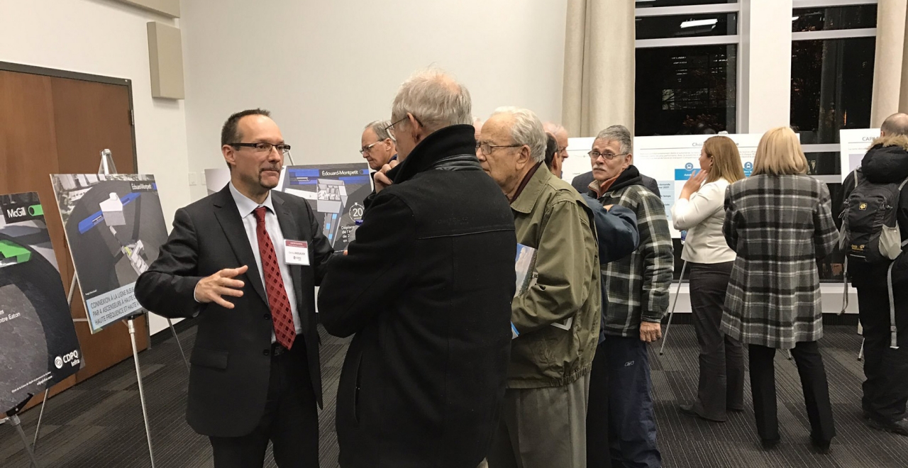
Open house and public meetings in 2016

Open house and public meetings in 2016
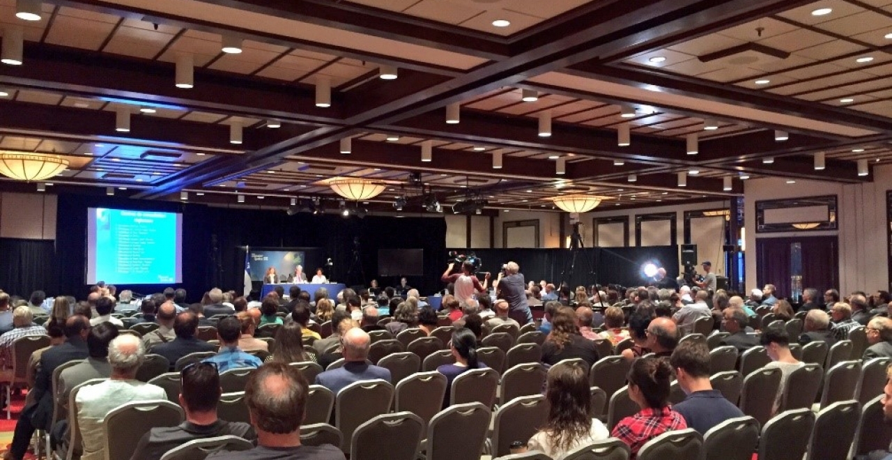
BAPE public hearings in 2016
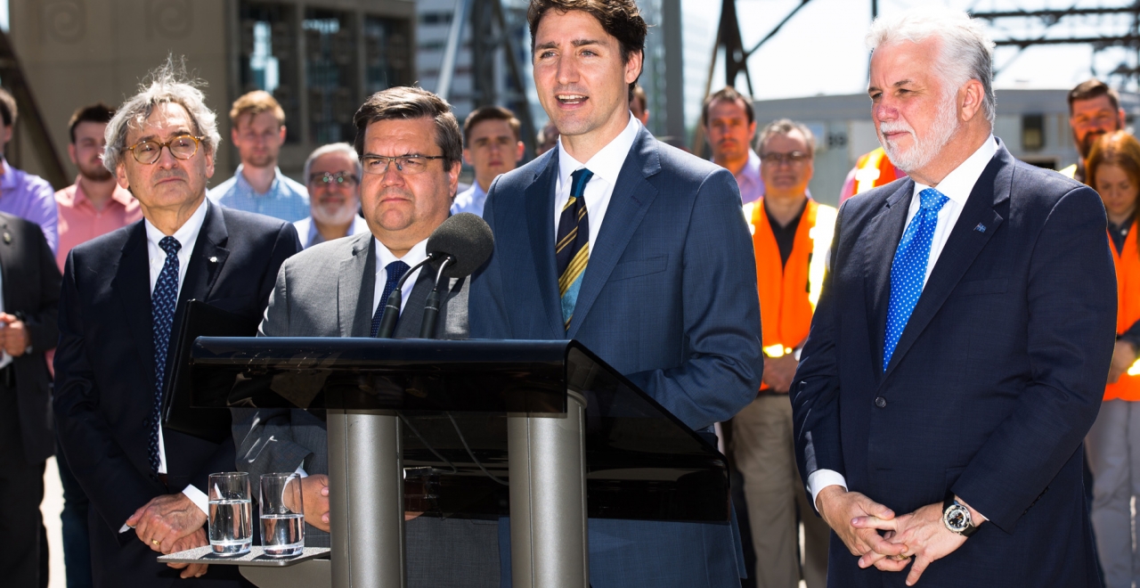
Confirmation of federal funding in 2017
1 / 5
MAP #3 – 2018: confirmation of selected consortia and groundbreaking
 In February 2018, as the two consortia (NouvLR and GPMM) that will build and operate the project were confirmed, the REM logo was presented to the public for the first time.
The word "électrique" in the project name became "express" in the new name – "Réseau express métropolitain." The map was updated. The originally proposed "Highway 13" station was removed due to estimated low ridership.
On April 12, 2018, construction was launched with a groundbreaking ceremony. Construction began on the South Shore, on the Deux-Montagnes branch and at Édouard-Montpetit.
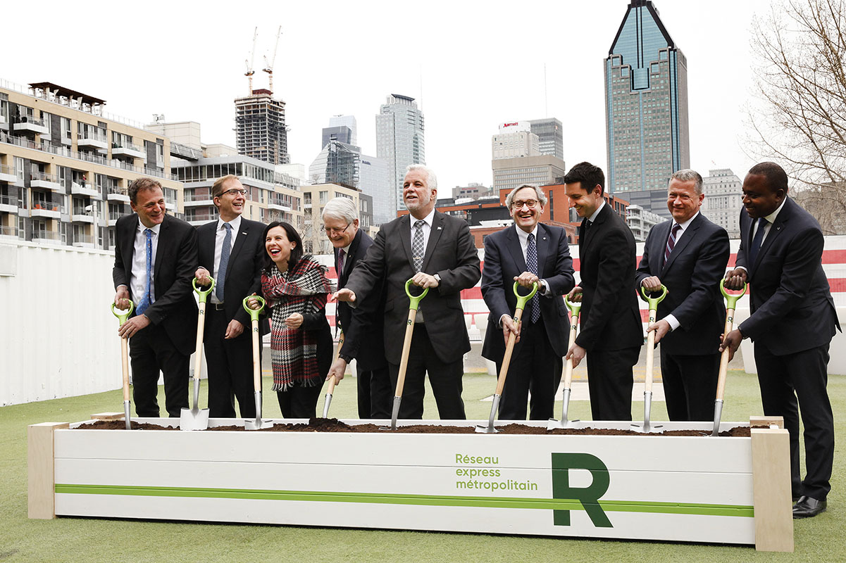 Groundbreaking for the REM, Griffintown, April 12, 2018.
2019: Work gets underway
In 2019, there were no changes to the map. However, construction sites started to get busy!
In 2019, the first stations began to take shape on the South Shore. The Du Quartier Station in August 2019.
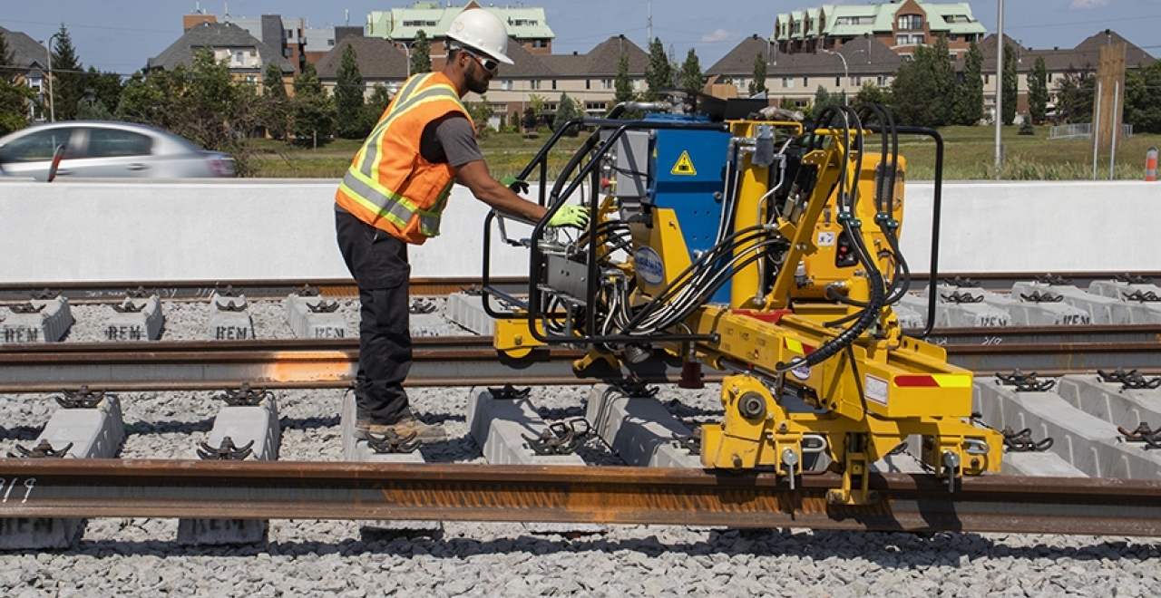
By the summer of 2019, the first rails were laid on the South Shore.
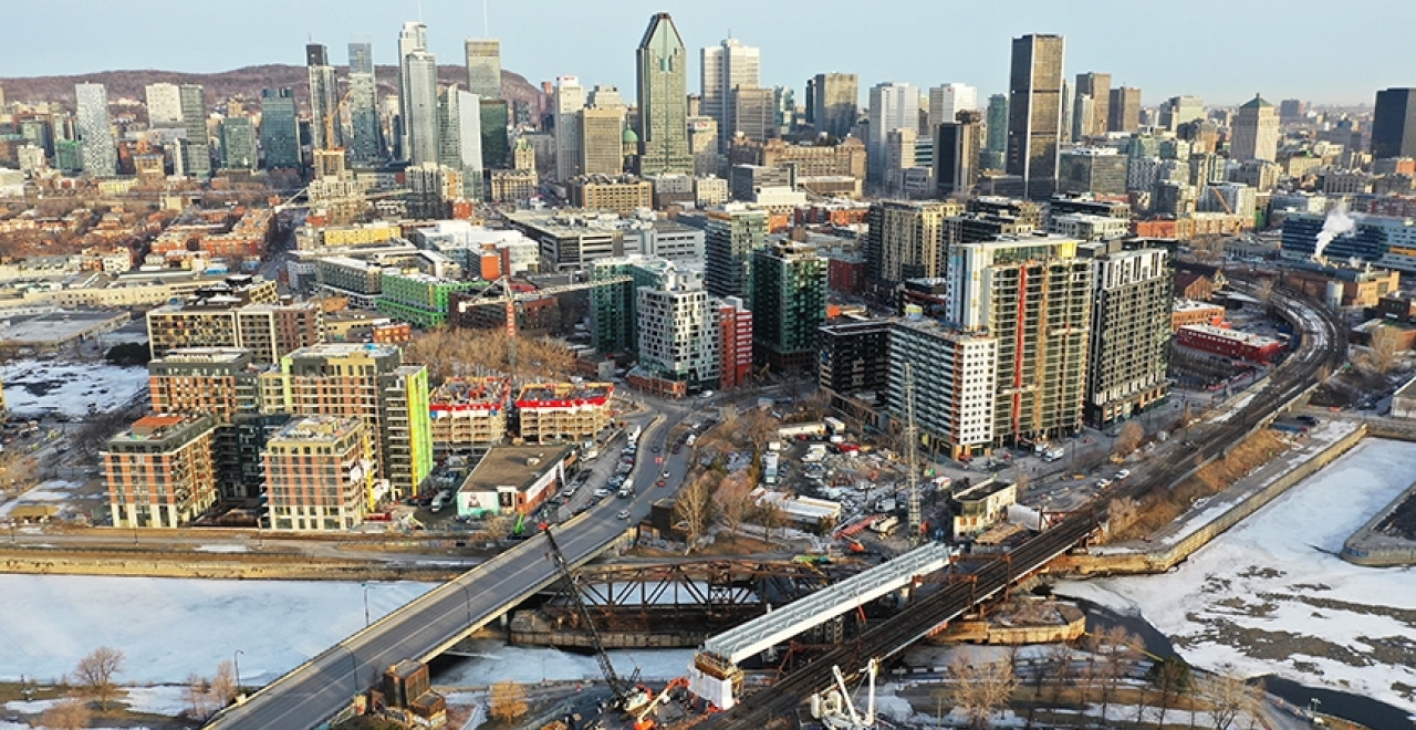
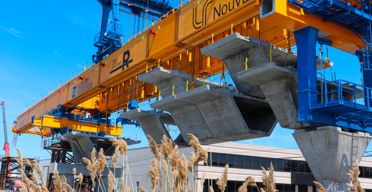
By the end of winter 2019, the first beams for the elevated structure were installed in the Lachine Canal sector.
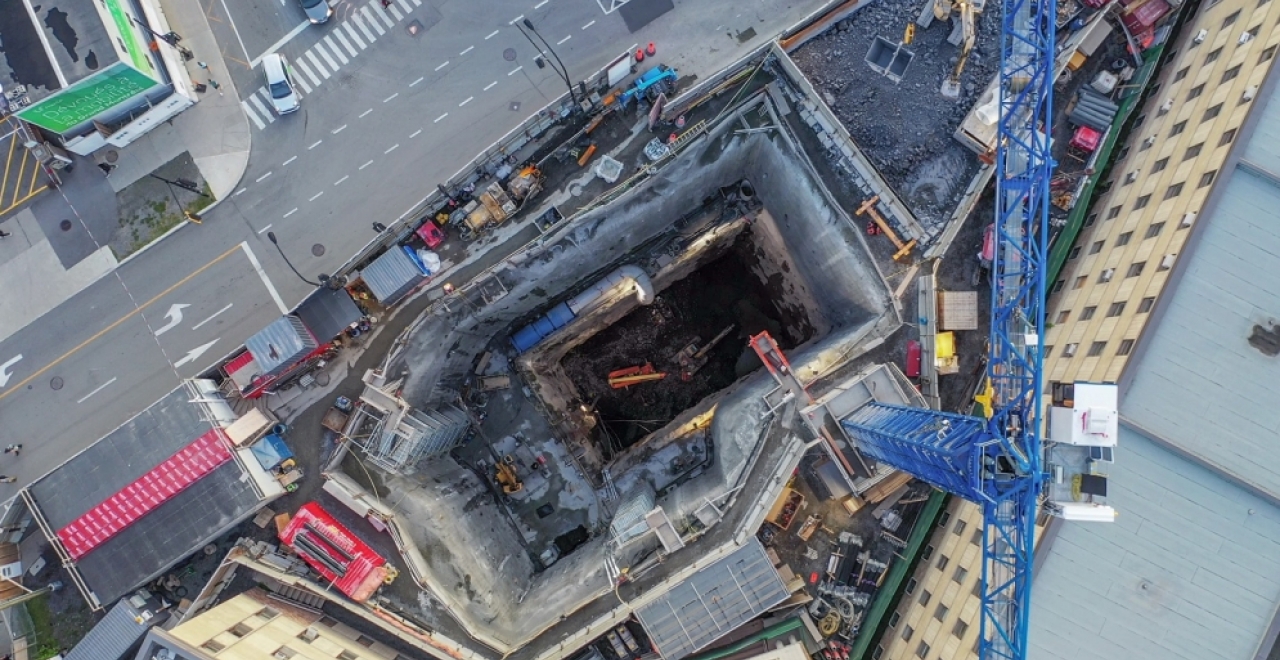
September 2019 marked the completion of the excavation of the main shaft for the Édouard-Montpetit Station.
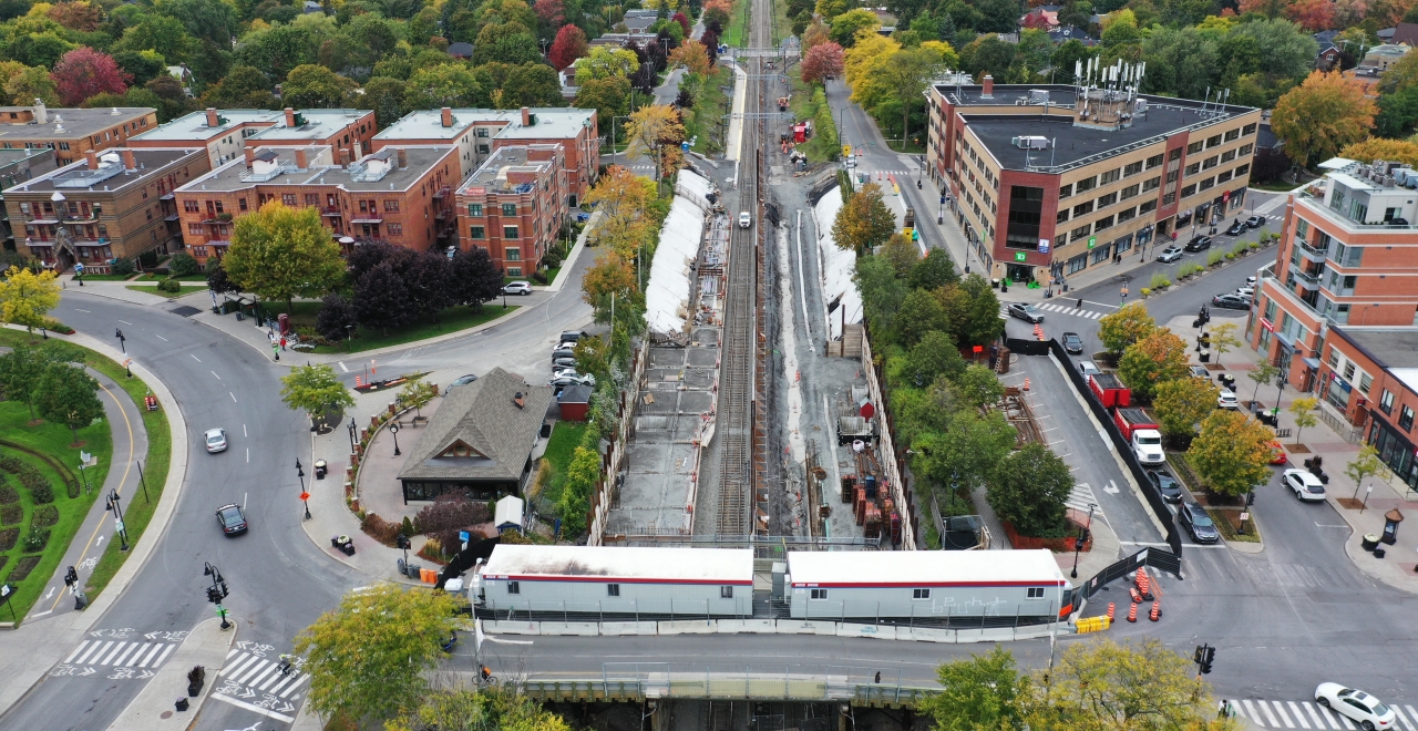
The Ville-de-Mont-Royal station in 2019.
In June 2019, Anne and Marie went into action and began the work of building the elevated structure on the West Island.
1 / 6
MAP #4 – 2020: Station names confirmed
 In early 2020, the station names were updated.
In February 2020, the station toponymy became official. Eight stations would change their names:
- Rive-Sud Station became the Brossard Station
- Mont-Royal Station became the Ville-de-Mont-Royal Station
- Correspondance A40 Station became the Côte-de-Liesse Station
- Technoparc Station became the Marie-Curie Station
- Aéroport-Montréal-Trudeau Station became the YUL-Aéroport-Montréal-Trudeau Station
- Roxboro-Pierrefonds Station became the Pierrefonds-Roxboro Station
- Pointe-Claire Station became the Fairview-Pointe-Claire Station
- Sainte-Anne-de-Bellevue Station became the Anse-à-l’Orme Station
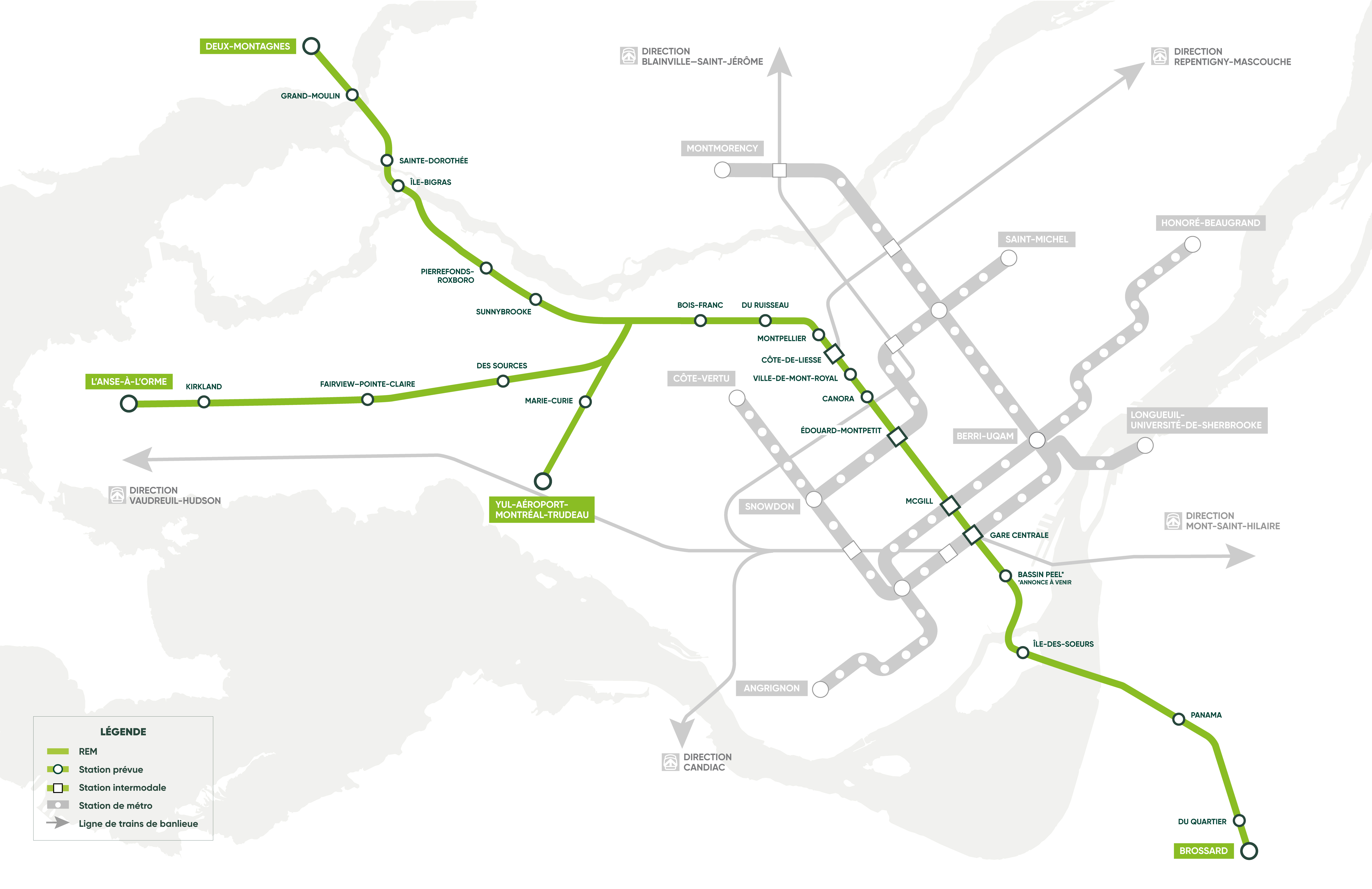
MAP #5 – 2020: Griffintown-Bernard-Landry Station unveiled
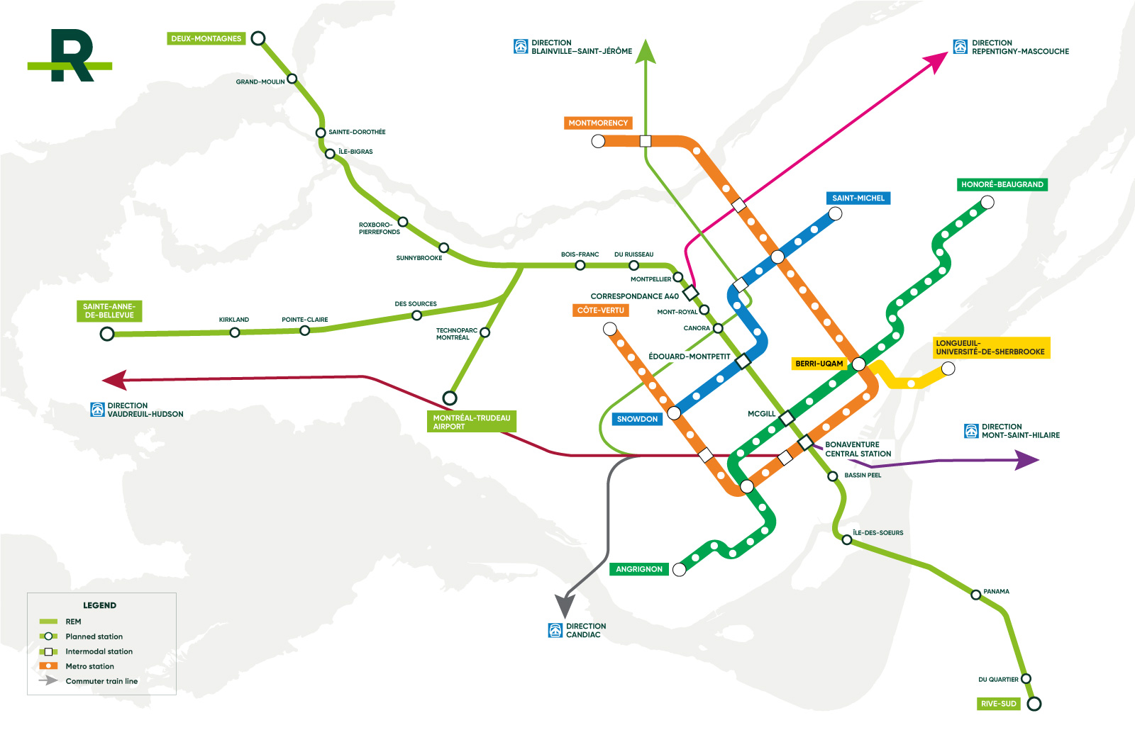
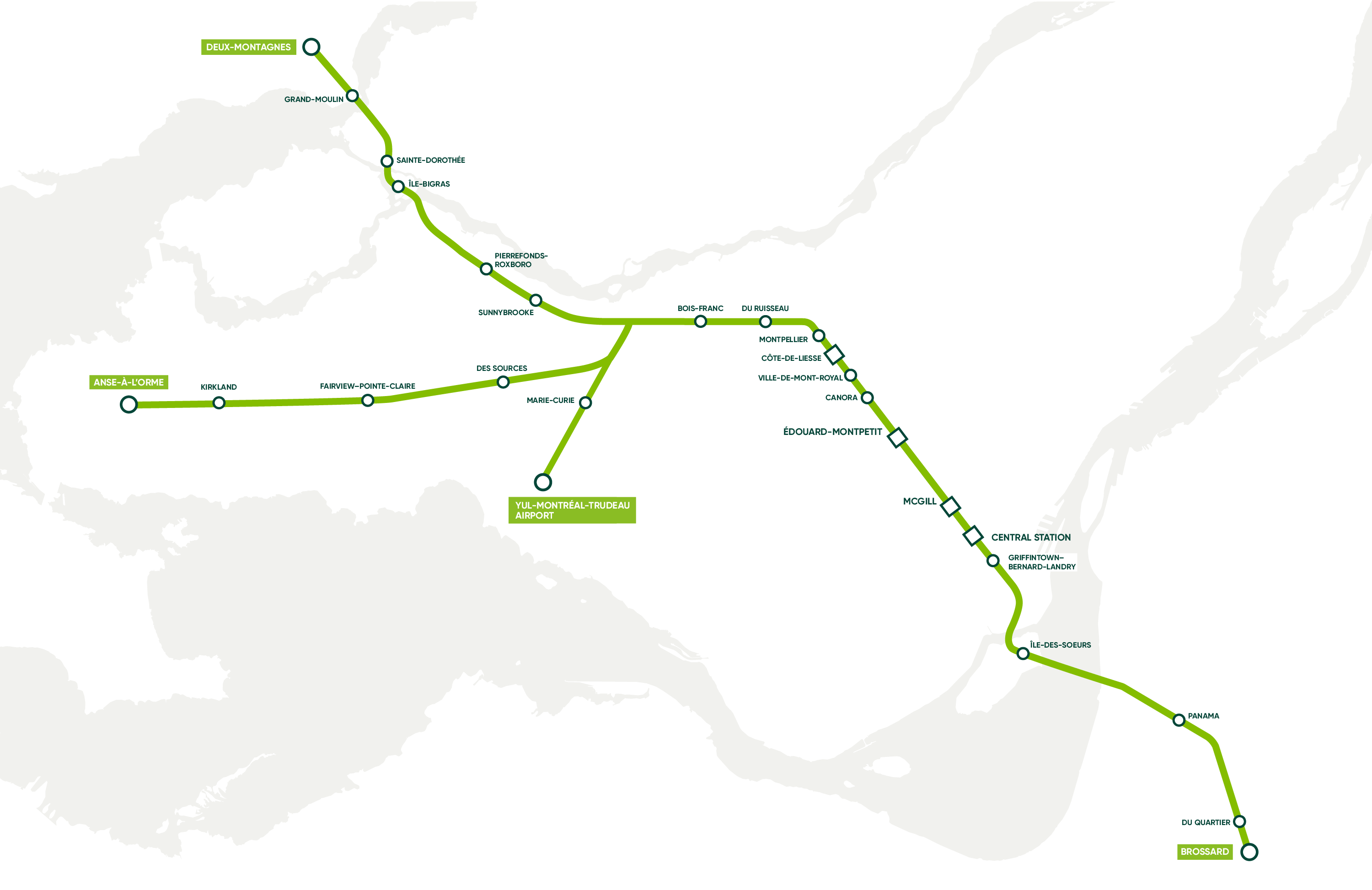 In the summer of 2020, the Bassin Peel Station was renamed the Griffintown Bernard-Landry Station, and its location was made official. This map became the final map for the REM project.
The Griffintown–Bernard-Landry Station is the final station confirmed for this project. The REM therefore officially consists of 26 stations, more than 20 of which are currently under construction.
2021: More active construction sites than ever and preparation for commissioning
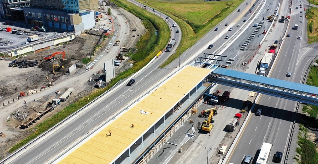
Today in 2021, construction sites are active in all sectors and teams are preparing for commissioning.
As you may have noticed during the unveiling of the REM cars in the fall of 2020, some maps are now being prepared to accompany future users in the network.
A linear map will be installed in the REM cars above each door.